WESTERN WASHINGTON — Some people are still without power after windy weather roared across Western Washington.
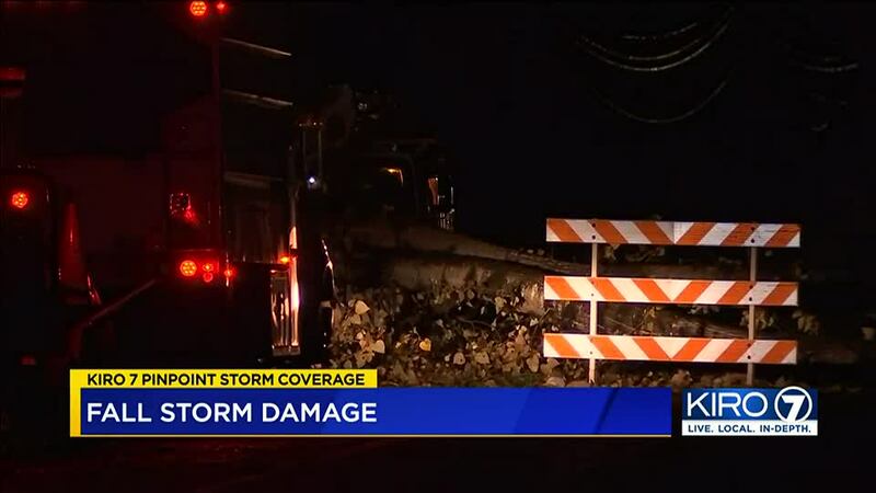
Puget Sound Energy said crews made steady progress Monday as periodic wind gusts continued. Strong winds in Kitsap County on Monday added an additional 13,000 power outages. But after moving additional crews to the area, that number was down to about 3,000, with about 4,500 outages overall as of early Tuesday.
While the worst of the wind is behind us, it’s another day of cleanup after strong gusts brought down trees and powerlines, and crews are still working to restore power.
0 of 20


[DOWNLOAD: Free KIRO 7 Weather app to track the storm on your phone
Sunday’s high winds ended in tragedy when a tree crashed onto a car in Fall City, killing two people.
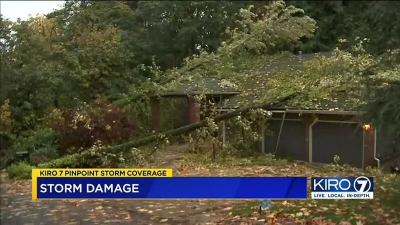
Trees across the Eastside were no match for the fierce winds. Tree limbs, fallen leaves and other debris came down from Sammamish to Issaquah to Mercer Island. Two trees fell on a house on East Mercer Way on Mercer Island.
Everett saw wind gusts of 61 mph on Sunday.
While most people had their power back on by Monday, some were still left in the dark like Mary Bishopp-Woods and her husband.
She says she wasn’t expecting the weekend storm to wallop the area the way it did. But more than 24 hours after the lights first went out they were still without power.
The couple forced to bundle up and cook outdoors. “We’ve got a camp stove that we used outside to cook dinner,” says Bishopp-Woods.
The brunt of the storm hit Sunday, and that’s when a tree fell onto Cynthia Gray’s home.
“A big crash, dust, smoke, everything just from the ceiling caving in there in the bedrooms,” she says.
Gray says the damage has rendered her home uninhabitable. Now she and her family are figuring out their next move.
" Don’t know what I’m going to do,” says Gray. “Get help to get the house packed up and put everything in storage until we find somewhere else to live. Right now it’s up in the air.”
>>KIRO 7 StormTracker Doppler Radar Livestream
FORECAST
A weak system will move through Tuesday, giving us increasing showers later this morning and into the afternoon.
“I also expect it’ll be breezy at times, but nothing as strong as the past couple of days. Showers should taper around dinner time with highs in the mid-50s,” KIRO 7 Meteorologist Nick Allard said.
Wednesday there will be a few showers around but they will be scattered and mainly in the mountains. However, rain will increase late in the day and be heavy at times.
The heavy rain is from an atmospheric river that will produce very heavy rain. The question is, where does it stall? Right now, the computer models put some of the heaviest rain north of us.
Still, during the day Thursday it will be very wet. I do expect rises in area rivers and we’ll keep an eye on that. We could see 1-2″ of rain just in the lowlands. Again, we need to keep an eye on where the heaviest rain stalls out.
Friday morning the rain should start to move south of the area, giving us drier conditions in the afternoon along with a little sunshine. At this point the weekend looks mainly dry with some decent sunshine!
©2021 Cox Media Group


