WESTERN WASHINGTON — A strong weather system arrived in western Washington Friday night and into Saturday with heavy mountain snow along with rain and strong winds in lowland areas.
MOUNTAIN SNOW:
That weather system produced sustained winds of 30 to 40 mph but also brought snow to the mountains, which caused a Winter Storm Warning to be issued in the mountains through Sunday morning. This will be the heaviest snow event of the season so far for the Cascades and Olympics with one to three feet of new snow — including all the mountain passes.
Pass closures are expected at times late Saturday night through the weekend. A total of 18-36 inches of snow is expected to fall in the Cascades through Sunday.
Rough conditions right now and likely the rest of the night into tomorrow AM on Snoqualmie & Stevens. Chains required for all except AWD/4WD on both. Please follow those requirements and be prepared for slow-going if traveling across tonight. https://t.co/NQ42NX3LNA
— Washington State DOT (@wsdot) December 12, 2021
And although the snow will continue through Sunday, the mountains are not expected to get hit as hard as Saturday. Traveling through the passes will still be very difficult though.
Heavy snow in the mountains & passes above 2000 ft thru Sunday AM could make travel difficult. Be sure to check the latest road and pass conditions at https://t.co/c7V95oUAnj or call 511. #wawx pic.twitter.com/ZZqytsuxA2
— NWS Seattle (@NWSSeattle) December 12, 2021
>>Download the KIRO 7 Weather App to track the storm live on your phone
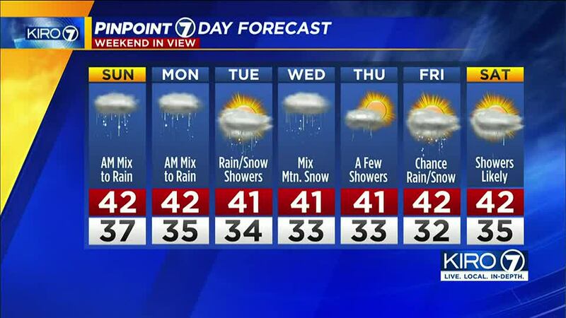
Overnight there could be a few snowflakes mixed in with the rain to start Sunday with scattered showers throughout the day. The rain will taper off in the lowlands as the day goes but there could be a chance for an isolated thunderstorm around the region in the afternoon and evening.
The highs for the day are expected to be in the 40s in the lowlands.
NEXT WEEK:
Starting Monday, it is expected to be chilly, taking us into the end of the week with lows in the 30s and highs in the low 40s around the lowlands.
While moisture looks pretty meager, snow levels will likely be below 1,000 feet, especially in the overnight and morning hours. Some snow could fall along with rain at times. While significant accumulations aren’t expected, that is subject to change if moisture becomes more robust.
©2021 Cox Media Group


