Fall officially arrives at 5:05 this evening, and the numbers show just how quickly we start losing the heat from here.
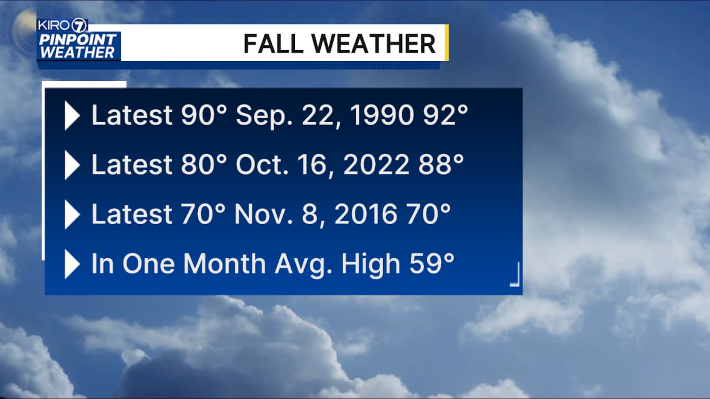
Seattle’s latest 90-degree day on record was September 22, 1990 — exactly 36 years ago today.
The latest 80-degree day was October 16, 2022, while the latest 70-degree day was November 8, 2016.
For today, we’ll start with plenty of clouds and a chance for some spotty drizzle or mist, mainly around King and Snohomish Counties. That should be limited to the morning, with some sunbreaks developing this afternoon. Highs will be in the upper 60s, right around average.
Tomorrow brings another weak system with at least a few pockets of morning sprinkles, although most of us will stay dry. We’ll gradually see more sunbreaks during the afternoon.
Thursday is the wetter day. We’ll start dry, but clouds will increase with showers developing during the afternoon and evening. Snow levels will drop to around 6,000-7,000 feet, so a little snow is possible at the highest elevations. Showers will linger into Friday, gradually decreasing through the day. Highs Thursday and Friday will be in the low to mid-60s.
The weekend looks drier, with morning low clouds giving way to some afternoon sun. Highs will stay in the low to mid-60s.
And the trend from here is pretty clear: Seattle’s normal high drops below 70 degrees Wednesday, falls to 66 by October 1, and is down to just 59 degrees a month from now. Summer may be officially ending tonight, but the normal temperatures are disappearing quickly, too.
©2026 Cox Media Group


