WASHINGTON — El Niño is already flexing its muscles, and we’re beginning to see weather patterns across the Northern Hemisphere that look familiar for a strong event.
We’ll be watching the December-through-February winter season most closely for El Niño’s influence, but a strong storm system hitting California with flooding and heavy Sierra Nevada snow fits the pattern we often see during El Niño winters.
El Niño is the warm phase of the El Niño-Southern Oscillation, or ENSO. It’s a recurring climate pattern marked by warmer-than-average ocean temperatures along the equatorial Pacific. Its counterpart, La Niña, features cooler-than-average water in the same general area.
Those warmer or cooler waters can cause changes in tropical rainfall and winds that ripple through the atmosphere, eventually influencing the jet stream, storm tracks and temperature patterns across North America.
For us in the Pacific Northwest, El Niño doesn’t have much influence on our summer weather. But as we move into winter, its fingerprints can become much more noticeable.
And this is shaping up to be one of the strongest El Niños we’ve seen.
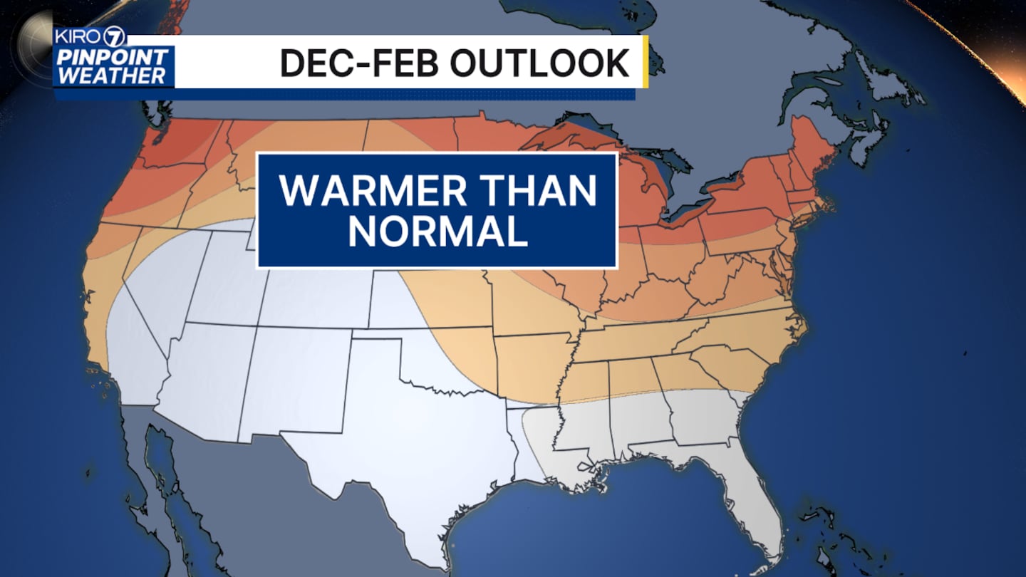
The winter outlook from NOAA’s Climate Prediction Center is also lining up with some of the classic characteristics of a strong El Niño: warmer-than-average conditions favored across the Pacific Northwest and a stronger signal for wetter-than-average conditions across California and much of the southern tier of the country.
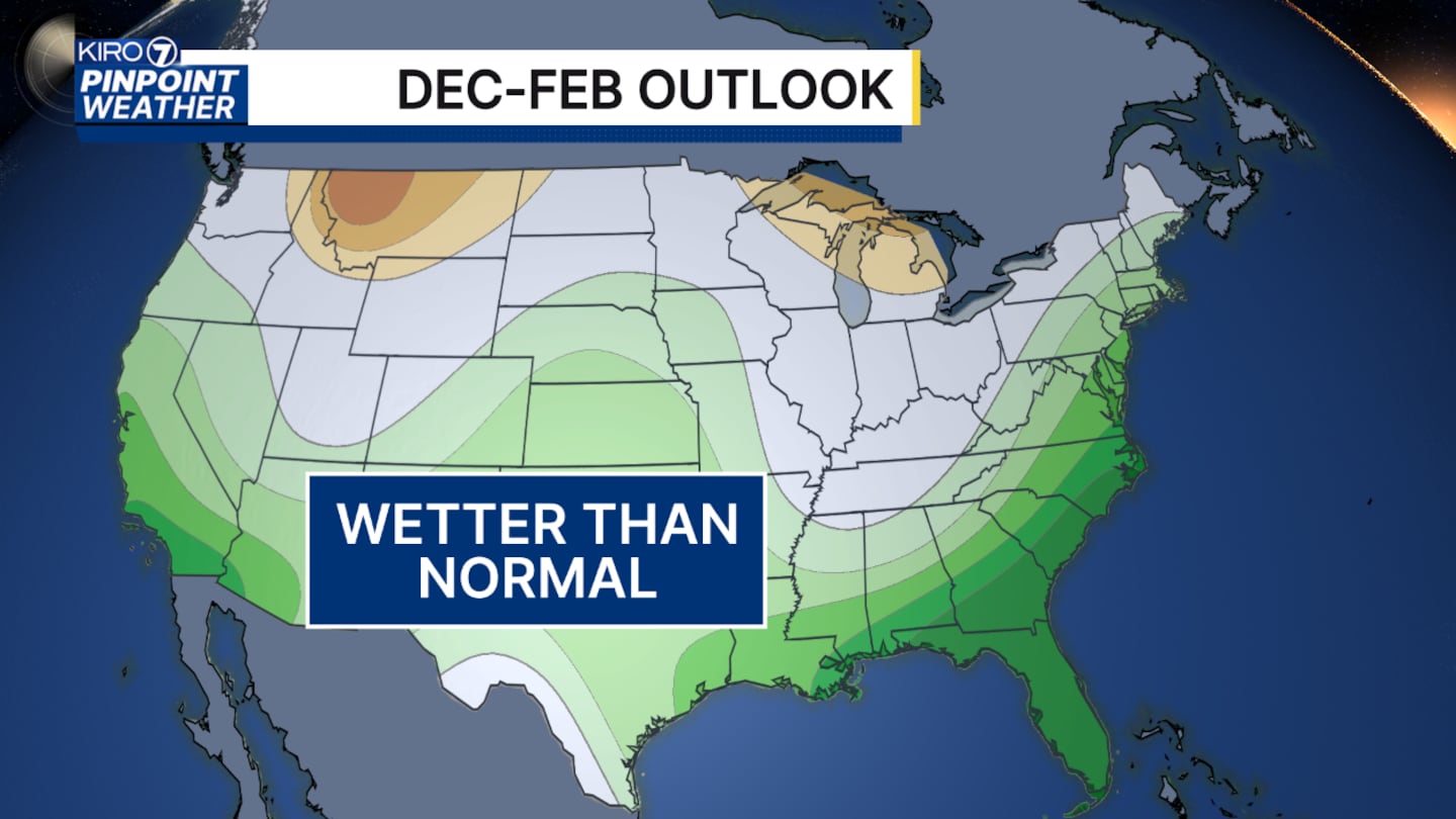
For the Northwest, however, the precipitation forecast isn’t nearly as clear-cut.
And that’s important when we start talking about mountain snow.
During strong El Niño winters, there are different ways we can end up with less-than-ideal snowpack:
- Warmer and wetter
- Somewhat cooler, but drier
Neither is particularly good news for building and maintaining mountain snowpack.
Consider the first scenario: We get plenty of precipitation, but winter temperatures run warmer than normal. That means higher snow levels and more precipitation falling as rain instead of snow at lower and middle elevations of the Cascades. Snow that does accumulate can also be more vulnerable to warm, rainy systems later in the season.
On the flip side, we could occasionally get cold air but relatively little precipitation. Temperatures might be perfect for snow, but without enough storms, the snowpack still struggles to build.
But here’s the important part: El Niño isn’t a winter forecast by itself!
Even a very strong El Niño only shifts the odds toward certain weather patterns. It doesn’t determine what happens on any particular day, week or even month.
A handful of big Cascade snowstorms, combined with relatively few prolonged warm and rainy periods, could still leave us with respectable mountain snowpack and a decent ski season.
Skiers and boarders, there is hope!
©2026 Cox Media Group