Well, that was interesting.
From a meteorological point-of-view -- and in hindsight of a few hours -- we see what happened. The low pressure that ran up the Oregon and Washington coast intensified quickly from next to nothing Friday to a formidable storm Saturday.
But it intensified far less than almost ALL of the computer forecast models and data -- the best science -- predicted it would. %
%
By the time the early evening rolled around, analysis showed a storm with a central barometric pressure of 974 millibars (28.76 inches on your home barometer). OK, but not exactly an overachiever. (The higher the barometric pressure in a low pressure system, generally the weaker the wind speeds.)
>> PHOTOS: Damage from Pacific Northwest storm
Meteorologists believed that we would still get some good 50+ mph gusts in some areas and that DID happen. However, widespread winds were thankfully avoided.
Exactly why so much of the computer modeling failed us will be something meteorologists will study to determine what went wrong in the multi-million dollar supercomputers. That will take some time.
But let me go into the timeline of what happened...
Wasn't a typhoon coming for us?
No. We were never going to be hit with a typhoon. I made that very clear on KIRO 7 News on multiple occasions.
It was interesting from a meteorological point-of-view that a typhoon was going to become involved with a windstorm for the Northwest. Unfortunately, the mere mention that there would be a connection to a typhoon -- much less a "Super Typhoon" had imaginations running wild.
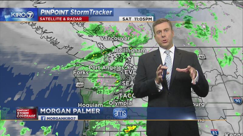
>> Click here for our live PinPoint Stormtracker radar.
There was even a viral internet article from a non-meteorologist claiming that "the biggest storm in history" was going to slam into us with 50 foot seas. Ridiculous rubbish. But it took off on Facebook and by Friday I had plenty of people asking me if that was really going to happen.
Friends: We live in a new age when reasonable and truthful information from reliable sources is often overlooked for the most apocalyptic scenario. This "clickbait static" makes communication of potential weather threats more difficult.
Back to the weather maps...
The remnants of Super Typhoon Songda traversed the Pacific and was the nucleus for the storm that gathered out in the Pacific in the past 24 hours. (Some might argue that Songda's remnants were actually so unrecognizable by Friday that any input from that system should have been discounted. Debatable.)
It's very clear now, though, that the computer forecast models did not handle Songda well at all in the forecasts issued early to mid week. %
%
Check out the U.S.-based GFS model forecast issued back on Wednesday for the Saturday windstorm. That is a forecast for a 957 millibar (28.26") behemoth of a storm a few hundred miles off the coast. Most other forecast models agreed with that and some were even more aggressive with the placement closer to us.
Trust me, being hit with that? It would have been a devastating storm of historic proportions.
So, why did the message change so quickly today?
By Friday, we knew that the so-called "worst case" scenario -- something like the record-setting Columbus Day storm of 1962 -- was likely off the table. All indications were for a weaker, yet still formidable storm Saturday. %
%
As the forecast evolved Friday and Friday night along with the storm, we were concerned with a substantial storm taking a similar path as the last big windstorm in the Northwest, the Inauguration Day storm of 1993.
As late as Saturday morning, the North American model (a respectable model) was still showing a strong 967 millibar (28.56") cyclone moving along almost the exact same path as that 1993 storm. In fact, the 967 millibar pressure prediction by the morning NAM model was actually stronger than the central pressure in the 1993 storm, which was troubling to say the least.
Almost all other forecast models had a weaker storm but still a good blow for the Northwest. This was something to be closely monitored.
So, meteorologists and weather lovers everywhere gathered together today to watch what was going to happen. My colleagues in broadcast media, academia, the National Weather Service and elsewhere were pretty convinced we'd have a rather notable storm. One in which we'd have widespread power outages and lots of damage because foliated trees would be more susceptible to toppling.
Yes, we had some of that. But...
The storm never strengthened much during the day
As the storm moved up the coast, there were some 80-100 mile per hour gusts recorded along the Oregon coast and in some higher elevations to our south. There were 60 mile per hour winds detected by Doppler radar just off the ground over King County this evening, just occasionally being brought to earth resulting in 50+ mile per hour gusts.
However, the central pressure of the storm kept fairly consistent as it traveled north along our coast. Normally, a storm like this would deepen -- or intensify -- of the Oregon and south Washington coast reaching it's zenith in low pressure prowess along our central or north coast before beginning a weakening phase near or after landfall.
Meteorologist Kelly Franson and I convened at KIRO 7 studios around midday and still the storm was sputtering.
One possible reason was put forward by the Portland National Weather Service office in their mea culpa Saturday evening:
"Second, an advanced scatterometer from satellite passed over our low pressure system at 10:45 AM PDT. This scatterometer shows the winds near the surface. What we saw left all of us here scratching our heads. There were 2 centers of circulation! In a typical low pressure center there is only one center of circulation and there were no forecast models forecasting this second low. When the energy is spread between 2 low pressure centers instead of one, the central pressure and winds associated with the system are typically significantly lower than they would be if it were one center of circulation."
It appears that there was a spreading out of wind because of these dual low pressure centers in the storm. Like two heads are better than one? In this case, not so much.
The center of the rather small low pressure system also was slightly farther offshore than the perfect, or "classic", Seattle windstorm track that some forecast models had indicated. The farther away from the storm, generally the weaker the wind where you are.
But even after that, our hourly high-resolution forecast models (time-tested and always being improved) still indicated some danger in the hours ahead.
So we meteorologists HAD NO CHOICE but to keep relaying the message about a potential high wind threat, but we also started putting in words of optimism that the storm might not be as bad. Personally, I was still concerned because there was a lot of tree damage earlier on Saturday in the Portland area from winds in the 40-45 mph range. Where those winds were observed in Western Washington? Tree damage and power outages in many spots.
While I wish the science could have produced a better forecast for Saturday's storm, I am very relieved that we escaped this potential threat with relatively minimal damage as a whole, area-wide.
But, of course, I'm still hearing it from many of you! I just want you to know what happened. %
%
Rest assured, this is a storm that will be studied, especially when it relates to computer forecast modeling and how pesky typhoons can get into the mix.
On to a breezy Sunday and the big game. GO HAWKS!
Cox Media Group